WTG Hugoton - Informational Postings (Unofficial)

Owner: West Texas Gas, Inc.
Operator: WTG Hugoton, LP
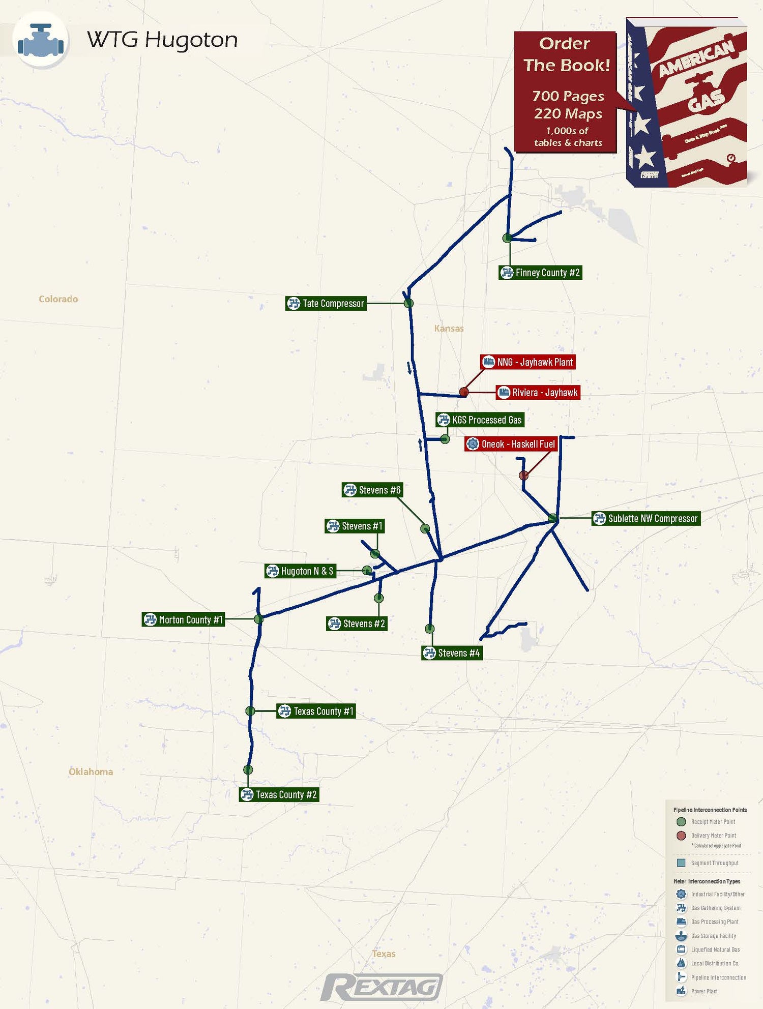
Miles of Pipeline: 152
System Capacity: 0.55 Bcf/d
Seasonal Storage: 0
Compressor Stations: 4

WTG Hugoton Pipeline Map

WTG_Hugoton Pipeline Map
  • Pipeline Description: WTG Hugoton covers 152 miles across various counties in Kansas and Oklahoma, owned by West Texas Gas, Inc., and operated by WTG Hugoton, LP. This pipeline is at its lowest utilization, primarily aiding producers, with significant customers including Scout Energy Group LP and Merit Energy Company.

Major Receipt & Delivery Points Charts
Top Receipt Points (MDth/d)
Top Delivery Points (MDth/d)
Major Receipt & Delivery Points Tables
Pick a Date:
Login to DataLink to choose more dates
Top Receipt Points (MDth/d)
Top Delivery Points (MDth/d)

General Information

Our informational Postings section covers all active interstate regulated (FERC) gas pipelines and storage facilities. Select a Pipeline or Storage Facility from the list below to view details such as a pipeline map showing meter points
 (interconnection points), daily gas flows for major points with historical volumes and a short description of the pipeline
system, its utilization, and customers