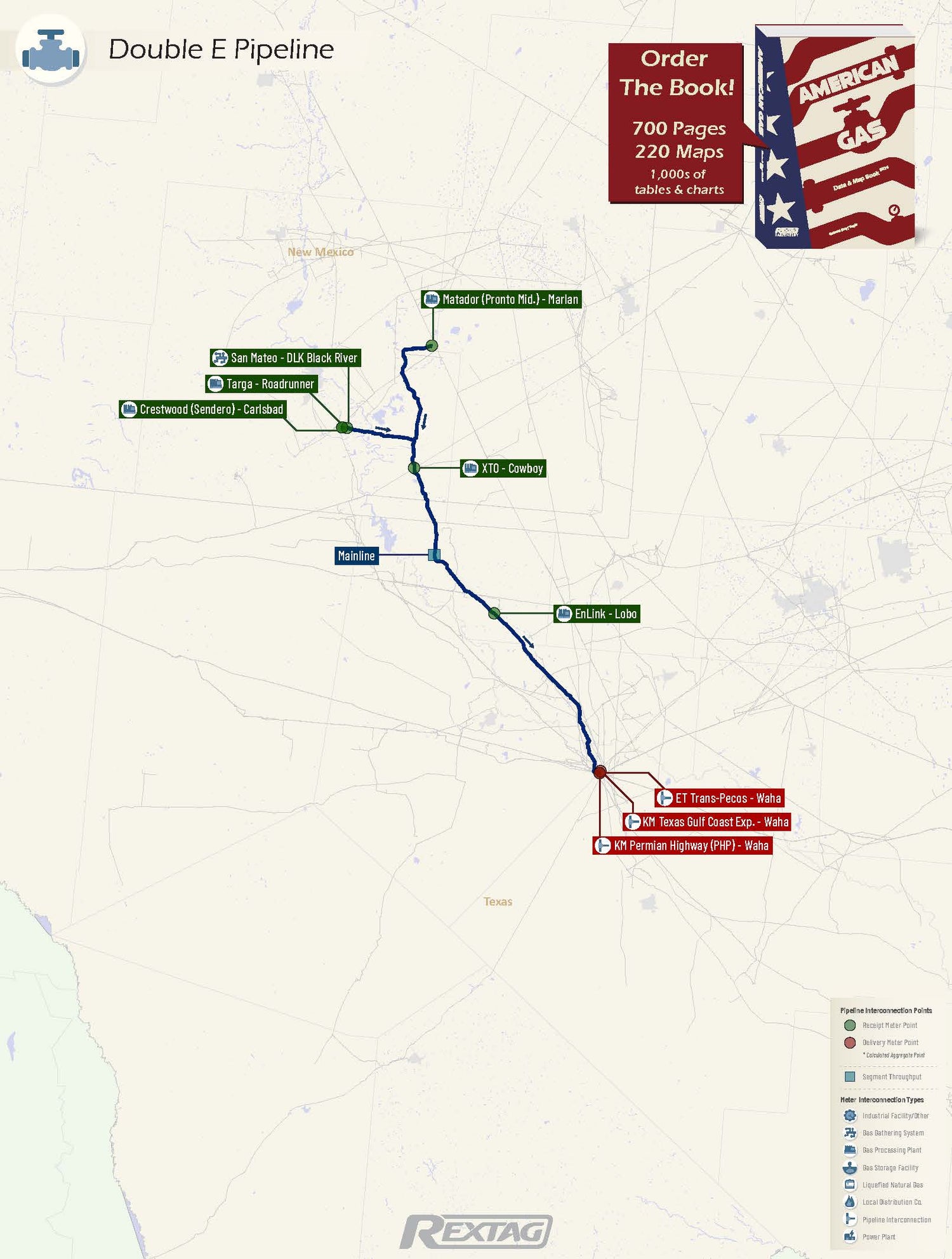
Double E Pipeline, LLC - Informational Postings (Unofficial)

Owner: Summit Midstream Partners, LP (70)/ExxonMobil (30)
Operator: Double E Pipeline, LLC
Miles of Pipeline: 135
System Capacity: 1.35 Bcf/d
Seasonal Storage: 0
Compressor Stations: 0

Double E Pipeline, LLC Pipeline Map

Double_E_Pipeline_LLC Pipeline Map
  • Pipeline Description: Double E Pipeline, LLC is a 135-mile pipeline traversing Eddy and Lea Counties in New Mexico and several counties in Texas, terminating at Waha in Texas. Jointly owned by Summit Midstream Partners, LP (70%) and ExxonMobil (30%), it's operating at less than 50% utilization. The pipeline primarily serves producers, with customers like XTO Energy, Inc. and MRC Permian Company.

Major Receipt & Delivery Points Charts
Top Receipt Points (MDth/d)
Top Delivery Points (MDth/d)
Major Receipt & Delivery Points Tables
Pick a Date:
Login to DataLink to choose more dates
Top Receipt Points (MDth/d)
Top Delivery Points (MDth/d)

General Information

Our informational Postings section covers all active interstate regulated (FERC) gas pipelines and storage facilities. Select a Pipeline or Storage Facility from the list below to view details such as a pipeline map showing meter points
 (interconnection points), daily gas flows for major points with historical volumes and a short description of the pipeline
system, its utilization, and customers